English Italiano Français Deutsch Español
Trovaci su Instagram

3-day trek on the Majella

Majella National Park · 3 days

Three days on the Majella: gorges, hermitages and peaks

Each day is a separate hike, linked to the next by a car transfer. Three versions of the same trip, from family walks to the ascent of Monte Amaro (2,793 m).

3 versionsFara San Martino GorgesOrfento ValleyMonte Amaro 2,793 mSpring–autumn

Version 1

Classic: villages, gorges and hermitages

The original itinerary of this guide, with updated data: three days graded E, suitable for hikers with some mountain experience.

Day 1 — Pennapiedimonte and the Sant'Angelo cave

Start: Pennapiedimonte, Balzolo (710 m)

Time: about 3 h 30 in totalAscent: about +450 mGrade: E

From the rock village of Pennapiedimonte, trail G1 climbs past old terraces to the Croce (1,055 m), overlooking the Avello Valley (about 3 hours return, +350 m). G1 continues to the Rifugio Pomilio (1,888 m), now closed. In the afternoon, drive to Palombaro (about 15 minutes) and walk from Sterparo (750 m) to the Sant'Angelo cave (850 m) in about 20 minutes. In spring 2026 some Palombaro trails were closed because of avalanche danger: check the list of open trails.

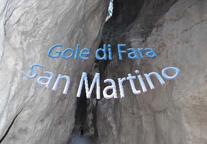
Day 2 — Fara San Martino Gorges

Start: Fara San Martino (440 m)

Time: about 3 h; 6 h with the Santo Spirito ValleyAscent: about +150 m; +650 m to Bocca dei ValloniGrade: E

Trail H1 enters the San Martino Gorges, a canyon with sheer walls, and reaches the ruins of the monastery of San Martino in Valle. About 3 hours return, suitable for families too; a helmet is recommended in the gorges. Fit hikers can continue up the Santo Spirito Valley to Bocca dei Valloni (1,050 m, about 2 h 30 from the village).

Read more →

Day 3 — San Bartolomeo hermitage and the Orfento Valley

Start: Roccamorice, then Caramanico Terme

Time: about 3 h in totalAscent: about +250 mGrade: ECar: Fara → Roccamorice about 1 h 15

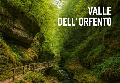
A short path with steps cut into the rock leads to the hermitage of San Bartolomeo in Legio (under an hour return). Then on to Caramanico Terme: after the compulsory registration at the Visitor Centre, walk the Scalelle trail (B6 and S), one-way from the Visitor Centre to the Ponte di Caramanico: about 1 h 30, closed in the rain. You cannot enter the valley from the Ponte di Caramanico; the Ponte della Pietra loop is partly closed after the storms of April 2026.

Read more →

Version 2

Easy, also with children

Short walks with little ascent and plenty of animals to see: chamois, wolves, otters and the plants of the botanical gardens.

Day 1 — Lama dei Peligni and the chamois

Start: Lama dei Peligni Visitor Centre

Distance: 2–3 kmAscent: minimalTime: 2 hGrade: T

The “Maurizio Locati” Visitor Centre, with its nature museum, the chamois enclosure and the “Michele Tenore” botanical garden. In the afternoon, a few kilometres away, the Marsican Bear Museum in Palena.

Read more →

Day 2 — Fara San Martino Gorges

Start: Fara San Martino (440 m)

Time: about 3 h returnAscent: about +150 mGrade: E

The first part of trail H1, as far as the monastery of San Martino in Valle: the narrow canyon thrills children who are used to walking. Hiking shoes and, if possible, a helmet.

Read more →

Day 3 — Caramanico, the otter and the Scalelle

Start: Caramanico Terme Visitor Centre

Time: about 1 h 30Ascent: about +120 mGrade: E

The “Paolo Barrasso” Visitor Centre has an otter enclosure; this is where you register for the Orfento Valley. The Scalelle trail descends past footbridges and rock walls to the Ponte di Caramanico, one-way. Alternatively, the botanical garden of Sant'Eufemia a Maiella, a few minutes' drive away.

Read more →

Version 3

High-level, for experienced hikers

Three long days on the western and eastern sides of the massif, including the ascent of Monte Amaro. Summer only, with no snow and stable weather.

Day 1 — Passo San Leonardo loop

Start: Fonte Romana, Passo San Leonardo (1,282 m)

Time: about 4 hAscent: moderateGrade: E

A warm-up day through meadows, beech woods, springs and dry-stone huts, with views of the Morrone and the Majella valleys.

Read more →

Day 2 — Monte Amaro

Start: Fonte di Nunzio (about 1,250 m)

Distance: 22–23 km returnAscent: over +1,500 mTime: full dayGrade: EE

Via the Stazzo and trail P1 you climb to the Forchetta di Majella (about 2,380 m), then across the Femmina Morta plateau to the summit of Monte Amaro (2,793 m). Water only at Fonte dell'Orso: carry at least 3 litres. The Pelino bivouac on the summit cannot be used as a shelter.

Read more →

Day 3 — Santo Spirito Valley and Bocca dei Valloni

Start: Fara San Martino (440 m)

Time: about 6 hAscent: about +650 mGrade: E/EECar: Passo San Leonardo → Fara about 1 h 15

Through the San Martino Gorges and the long Santo Spirito Valley to Bocca dei Valloni (1,050 m), where the amphitheatre of the eastern Majella opens up. Continuing to Monte Amaro (over 9 hours, more than 2,300 m of ascent) is only for very experienced hikers.

Read more →

All year round

Skiing, ski touring, snowshoes and horses

Skiing

Passo Lanciano and the Majelletta, on the northern side, have slopes in the woods and higher up. Skiing on the Majella

Ski touring

The classic is the Rava della Giumenta Bianca from Fonte Fredda to Monte Amaro: for expert skiers only, with transceiver, shovel and probe, after reading the avalanche bulletin. Passo San Leonardo · Ski touring in Abruzzo

Snowshoes

With snow, the Passo San Leonardo loop and the Majelletta woods become snowshoe routes. Snowshoeing in Abruzzo · Snow bulletin

On horseback

The park has a network of trails that can also be ridden, with departures from Passo San Leonardo. Passo San Leonardo

Before you go

Useful tips

  • Open trails: after the 2026 storms some trails are still closed: check the updated list on the park website.
  • Orfento Valley: free, compulsory registration at the Caramanico Visitor Centre; the Scalelle are one-way and closed in the rain; dogs on a lead (max 1.5 m) with a muzzle to hand.
  • Dogs: not allowed in the Zone A strict reserves; elsewhere always on a lead.
  • Water: springs high up are rare: at least 2 litres each, 3 litres for Monte Amaro.
  • Where to stay: there are no staffed huts open high up (Rifugio Pomilio is closed): B&Bs, farm stays and hotels in Fara San Martino, Palombaro, Caramanico Terme and Campo di Giove.
  • Gear: boots, wind and rain jacket, warm layer, hat and sunglasses, map or offline GPS track, first-aid kit and headtorch.
  • Rules: no camping, fires or picking flowers, fossils and rocks; no bathing in the streams.

Download the park tracks: KML routes · PDF sheets · GPXSee

Useful numbers

Contacts

Majella National Park Authority

Tel. +39 0864 25701

Email info@parcomajella.it

Website parcomajella.it

Registered office in Guardiagrele, operational office in Sulmona. All contacts in the park guide.

Caramanico Terme Visitor Centre

Tel. +39 085 922343

Registration for the Orfento Valley and otter enclosure.

Lama dei Peligni Visitor Centre

Tel. +39 0872 916010

Museum and chamois enclosure.

Fara San Martino information centre

Tel. +39 0871 980970

Information on the San Martino Gorges.

Abruzzo Regional Board of Mountain Guides

Tel. +39 375 607 8454

Email info@guidealpineabruzzo.it

Website guidealpineabruzzo.it

Mountain guides for Monte Amaro and ski touring.

Emergencies: 112 or 118 (also for mountain rescue).

Majella National Park guide: offices, visitor centres, rules and villages →

Distances and times are approximate for fit hikers, in good weather and without snow. Data checked in October 2026 (Park Authority, Caramanico Terme ordinance no. 36/2026, our Majella pages).

Three days in the Majella National Park with short car transfers between one day and the next. Choose the version that suits you: classic (gorges, hermitages and villages), easy for families with children, or high-level for experienced hikers, up to Monte Amaro.


View the map online

Skiing in Abruzzo – snow report

The most popular ski resorts, the updated snow report and useful information on how to find lifts or book accommodation for your winter holiday
Vai

Webcams in Abruzzo

View the webcams in Abruzzo and check real‑time weather conditions. Some webcams belong to www.abruzzoparchi.it, others are located throughout the region
Vai

Abruzzo weather

Weather forecasts for the coming days in Abruzzo. Live weather via our webcams and temperatures recorded in several mountain areas
Vai

Abruzzo trail maps

Maps for trekking, mountain biking, ski touring, running and horse riding. You can also download the GPX track of each route
Vai

Outdoor activities

Walks, diving, climbing, mountain biking, horse riding — all outdoor activities available in Abruzzo
Vai

Holiday in Abruzzo

Choose between sea or mountains, summer or winter, a sporty holiday or a relaxing one — Abruzzo has it all
Vai

Traditional Abruzzese cuisine

Abruzzo is famous for its cuisine, both mountain and coastal, with traditions that vary from area to area
Vai

Experience Abruzzo

Abruzzo’s villages are famous for their fortresses, mountains and the traditional trabocchi along the southern coast
Vai

Abruzzo, Lazio and Molise National Park

One of Italy’s most famous and oldest national parks
Vai

Gran Sasso and Monti della Laga National Park

One of Italy’s wildest parks, with typical Apennine landscapes and Dolomite‑like peaks
Vai

Velino‑Sirente Regional Park

Located in the heart of the Apennines, home to the beautiful villages of the Rocche Plateau
Vai

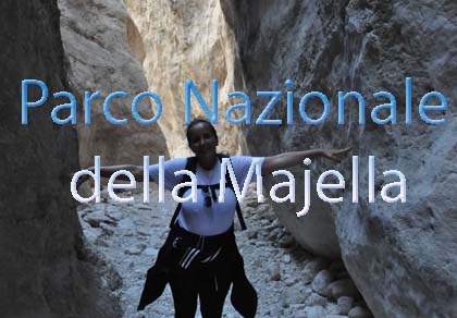
Majella National Park

One of the snowiest places in Italy, a unique mountain massif rising close to the sea
Vai