Not to be missed
Places to start discovering Abruzzo and, below, the four parks and the nature reserves.
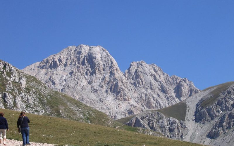
Corno Grande
2,912 m, the highest peak in the Apennines: the routes up from Campo Imperatore and Prati di Tivo.
Discover
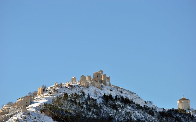
Rocca Calascio and the villages
The fortress at 1,460 m, Santo Stefano di Sessanio and Castel del Monte on the edge of Campo Imperatore.
Discover
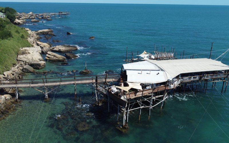
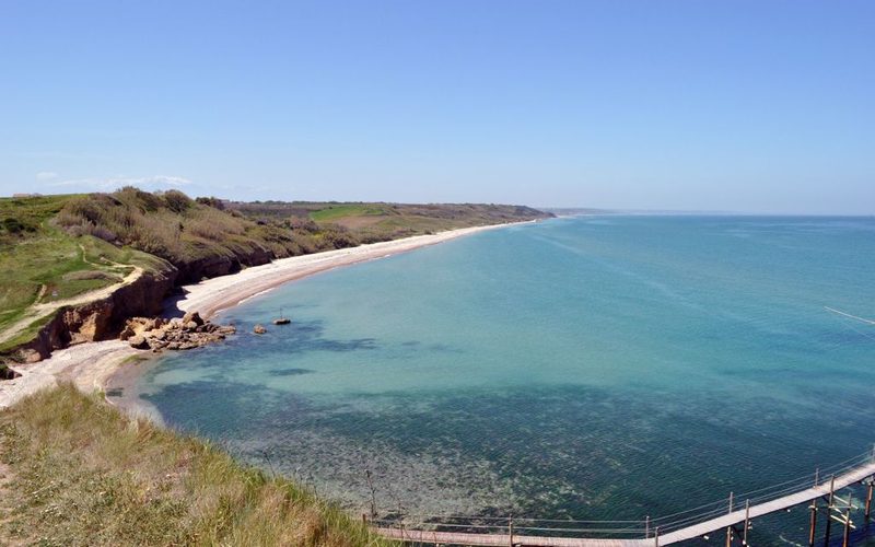
Trabocchi Coast
The old fishing machines over the sea, the coves and the coastal cycle path.
Discover
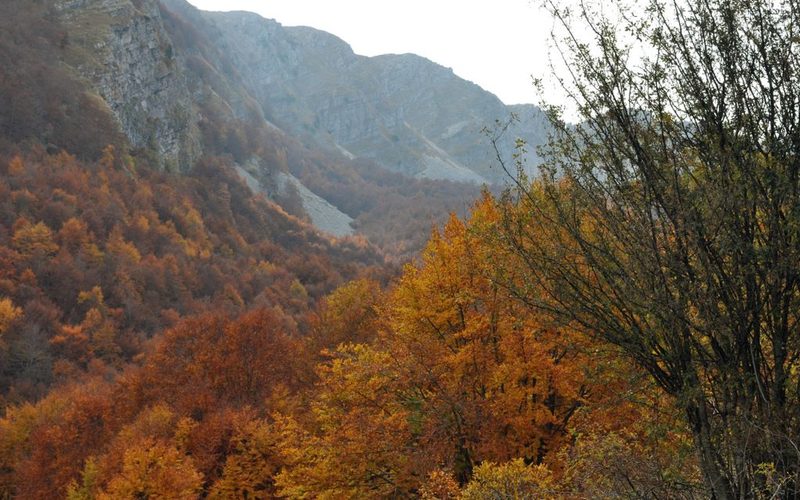
Three-day weekends
Four ready-made itineraries in the parks: Gran Sasso, Majella, Abruzzo Park and Velino-Sirente.
Discover
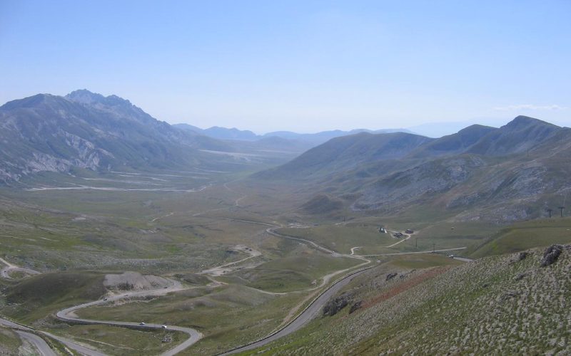
Gran Sasso and Monti della Laga
Campo Imperatore, the highest peaks in the Apennines and the woods and waterfalls of the Laga.
Discover
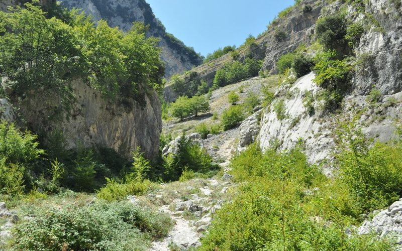
Majella
Hermitages, gorges such as Fara San Martino and Monte Amaro, 2,793 m.
Discover
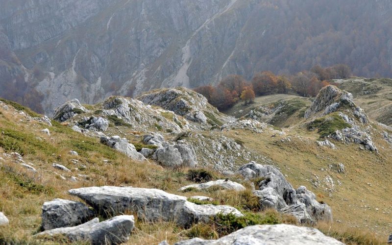
Abruzzo, Lazio and Molise Park
The oldest park: chamois in Val di Rose, the Camosciara, bears and wolves.
Discover
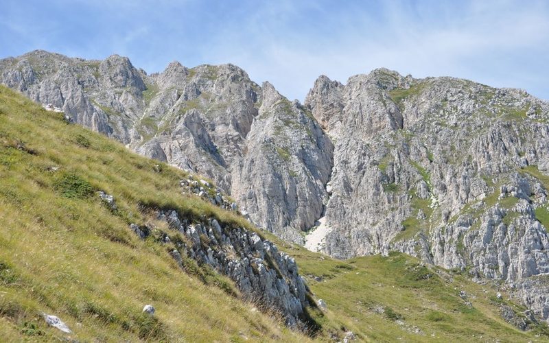
Sirente-Velino
The Sirente ridges, 2,348 m, Monte Velino, 2,486 m, and the Altopiano delle Rocche.
Discover
Nature reserves
From the Punta Aderci coast to springs and gorges: profiles, map and contacts.
Discover
🗺️ Interactive map
Discover Abruzzo on the map
Tap a province, a village or a point, or pick a map: GPX trails, parks, snow, families and flavours.
CitiesVillagesPlaces to visitParksSki resorts
Today’s conditions: snow, webcams and weather
Weather and webcams to see what it is like right now, plus the seasonal section: snow in winter, trekking in summer.
🌤️ Weather
5-day forecasts for 840 places with their altitude, from the coast to Campo Imperatore, radar and hour-by-hour maps.
Go to the weather
📷 Webcams
Live images from L’Aquila, the Gran Sasso and the central Apennines, also on a map.
View the webcams
❄️ Snow report
Lift status, snow depth and latest updates for Campo Imperatore, Roccaraso, Ovindoli, Campo Felice, Prati di Tivo and other resorts.
Open the snow report
🥾 Trekking
Trails in the four parks with maps, times and climbs, high-altitude huts and GPX tracks.
Trails and trekking
Things to do
Our themed guides: snow, families, cycling, GPX tracks, food and safety.
❄️ A day in the snow
Skiing, cross-country, snowshoes, sledging and ski touring: where to go and what you need.
Discover
🥾 Snowshoeing
The finest snowshoe routes, with difficulty, times and GPX tracks.
Discover
👨👩👧 Abruzzo for families
Easy nature, wildlife, caves, lakes and food to discover with children.
Discover
🚲 Appennino Bike Tour
The cycle route in Abruzzo: four stages with map and official data.
Discover
🗺️ Trail GPX tracks
Tracks to download, by area, with altitudes and times.
Discover
🧀 The flavours of the parks
Local produce, festivals and where to eat in each park.
Discover
⛑️ Mountain safety
What to know before you set off, in summer and winter, and the laws in force.
Discover
🏕️ Three days in the parks
Three-day itineraries with stages, trails, where to sleep and an easy family version.
Trails and activities
Field-tested routes with maps and GPX tracks, organised by park.
Abruzzo, Lazio and Molise National Park
Bears, wolves and chamois; villages such as Pescasseroli, Opi, Civitella Alfedena and Lake Barrea.
Park trails
Gran Sasso and Monti della Laga
Campo Imperatore, Corno Grande (2912 m), the Sentiero del Centenario, and the waterfalls and woods of the Laga.
Park trails
Majella
Hermitages, canyons such as the Valle dell’Orfento and the climb to Monte Amaro (2793 m).
Park trails
Sirente-Velino Regional Park
The ridges of the Sirente, Valle Majelama, the Altopiano delle Rocche and the Grotte di Stiffe caves.
Park trails
🗺️ Maps and GPX tracks
Trail maps and downloadable tracks for your GPS or smartphone.
Open the maps
🥾 Trekking
Interactive guide to routes across Abruzzo, sorted by difficulty.
Trekking guide
🥾 Trekking: the finest routes by massif
- Gran Sasso – Campo Imperatore: Sentiero del Centenario, Monte Aquila, Monte Portella and Corno Grande (normal route).
- Majella – Hermitages and peaks: Eremo di San Bartolomeo, the Valle dell’Orfento and the climb to Monte Amaro.
- Sirente-Velino – Plateaus and ridges: the Sirente ridge, Valle Lupara and the Altopiano delle Rocche.
- PNALM – Villages and wildlife: routes between Pescasseroli, Opi, Civitella Alfedena and Lake Barrea.
- Monti della Laga: moderate trails through woods, past waterfalls and with open views.
Tip: many routes are sun-exposed or at high altitude: start early, carry water and always check the weather.
❄️ Snowshoeing
- Campo Imperatore – Gran Sasso: routes towards Monte Aquila and the Sella di Monte Aquila.
- Altopiano delle Rocche (Rocca di Mezzo – Ovindoli): easy routes, suitable for families and beginners.
- Pescocostanzo – Bosco di Sant’Antonio: a monumental beech forest with a fairy-tale feel.
- Majella – Valle dell’Orfento and Colle della Civita: wilder, more technical routes.
- PNALM – Opi, Civitella Alfedena, Barrea: routes inside the Park with a chance of spotting wildlife.
All snowshoe routes
⛷️ Ski mountaineering
- Gran Sasso – Campo Imperatore: Monte Aquila, Monte Portella, Vallone delle Cornacchie.
- Majella – Monte Amaro: gullies and technical slopes for expert skiers.
- Sirente – north face: wild, little-frequented routes.
- Velino – Valle Majelama: a long ascent for fit skiers (Rifugio Sebastiani).
- Monti della Laga: broad slopes and snowy woods.
Ski mountaineering guide
🧗 Climbing
- Gran Sasso – Corno Piccolo: multi-pitch routes and technical slabs; base at Prati di Tivo.
- Pennapiedimonte – Majella: vertical and overhanging sectors.
- Rocca Calascio: classic limestone routes of moderate difficulty.
- Roccamorice: technical routes on sculpted limestone, with sectors for all levels.
- Monti della Laga: sandstone climbing in a wild setting.
- PNALM – Barrea: bolted crags for sport climbing.
Tip: many crags are sun-exposed: spring and autumn are the best seasons.
🚵 Mountain biking and gravel
Warning: in summer many areas are exposed to the sun: carry plenty of water and plan rides for the cooler hours.
Park rules and safety
Rules vary from park to park and from year to year: always check the official website before you go.
General rules in protected areas
- Stay on marked trails and do not pick flowers or plants or remove rocks.
- Do not feed the animals and keep your distance, especially from bears, wolves and chamois.
- Dogs must always be on a lead; in some areas they are banned altogether.
- Wild camping, fires and drone flights are generally prohibited without authorisation from the Park Authority.
- Carry your rubbish back down with you.
Limited-access trails in the PNALM
In summer, to protect the Apennine chamois, three trails in the Abruzzo, Lazio and Molise National Park can only be walked on a paid guided hike, booked with the guides appointed by the Park:
- I1 – Val di Rose: from Civitella Alfedena to the Rifugio di Forca Resuni.
- F1 – Monte Amaro di Opi: from Val Fondillo to the summit.
- L1 – Monte Meta: from Pianoro Campitelli to the summit.
In 2026 the rule applies from 25 July to 13 September, Tuesday to Sunday; access is not allowed on Mondays. Dates and guide contacts change every year: read the Park’s official notice.
Official park authority websites
In winter: for high-altitude hikes, snowshoeing and ski mountaineering, check the
Meteomont avalanche bulletin and carry a transceiver (ARTVA), shovel and probe.
Mountain emergencies: call 112 (the European emergency number). Before setting off, tell someone your route.
Explore Abruzzo
Villages, coast, lakes and nature: open the section that interests you.
🏰 Villages and towns
- L’Aquila: Collemaggio, the 99 Cannelle fountain and a reborn historic centre.
- Sulmona: medieval aqueduct, sugared almonds (confetti) and the slopes of Roccaraso and Campo di Giove less than an hour away.
- Avezzano: gateway to the Marsica, half an hour from the Ovindoli slopes and below Monte Velino.
- Scanno: a heart-shaped lake and photogenic lanes.
- Santo Stefano di Sessanio, Calascio and Castel del Monte: the villages of the Gran Sasso.
- Castelli: the capital of ceramics.
- Civitella del Tronto: one of the largest Bourbon fortresses in Europe.
- Guardiagrele: a capital of craftsmanship and gateway to the Majella.
- Roccaraso (1,236 m), Rivisondoli (1,320 m) and Pescocostanzo (1,395 m): the high plateaus, with skiing, snowshoeing and art villages.
- Castel di Sangro (805 m): basilica, Aufidena museum and fly fishing on the Sangro.
Villages and attractions
🌊 Adriatic coast and seaside activities
- Costa dei Trabocchi: cycle path, coves and restaurants on the trabocchi fishing platforms.
- Vasto: Punta Aderci and the historic centre.
- Pineto: pine forest, Torre Cerrano and calm waters.
- Pescara: seafront, museums and nightlife.
- Kayaking, SUP and snorkelling: the coves of the Costa dei Trabocchi, Punta Aderci, Ripari di Giobbe.
- Beach trekking: between Vasto, San Vito Chietino and Ortona, ideal in spring and autumn.
Guide to the coast
🏞️ Lakes
- Lake Scanno: Abruzzo’s most famous lake, shaped like a heart.
- Lake Barrea (PNALM): between Barrea, Civitella Alfedena and Villetta Barrea.
- Lake Campotosto: at the foot of the Gran Sasso, great for mountain biking and photography.
- Lago di Pietranzoni: the “mirror of the Gran Sasso” at Campo Imperatore.
- Lago Vivo (PNALM): a seasonal natural lake reachable on foot from Barrea.
- Lago di Sinizzo: not for swimming, with shallow shores; family-friendly.
- Lago di San Domenico: clear waters and the hermitage of San Domenico.
Note: the water level of some lakes varies with the seasons.
🦉 Nature reserves and WWF oases
🐾 Flora and fauna
- Marsican brown bear: symbol of the PNALM and one of the rarest species in Europe.
- Apennine wolf and Abruzzo chamois, which can be seen in the PNALM and on the Majella.
- Red deer, roe deer and golden eagles in the woods and on the mountain walls.
- Ancient beech forests: some are UNESCO World Heritage sites.
- Campo Imperatore grasslands: endemic species and spring wildflowers.
🍝 Traditional cuisine
Arrosticini, spaghetti alla chitarra, pecora alla callara, brodetto di pesce, confetti di Sulmona, Montepulciano d’Abruzzo, Pecorino and Trebbiano.
Typical Abruzzo food
🗺️ The four provinces
| Province | Landscape | Iconic places |
|---|
| L’Aquila | Mountainous: Gran Sasso, Majella, Sirente-Velino | Campo Imperatore, Rocca Calascio, Grotte di Stiffe, Madonna d’Appari, Sulmona, Avezzano |
| Teramo | Sea and mountains, Monti della Laga | Prati di Tivo, Civitella del Tronto, Campli |
| Pescara | Coast, modern city, gateways to the Majella | Valle dell’Orfento, Caramanico Terme, San Clemente a Casauria |
| Chieti | Sea, hills and villages | Costa dei Trabocchi, Vasto, Guardiagrele, Gole di Fara San Martino |
🌍 Geography
- Area: about 10,800 km², between the central Apennines and the Adriatic Sea.
- Mountains: Gran Sasso (Corno Grande 2912 m), Majella (Monte Amaro 2793 m), Sirente-Velino.
- Plateaus: Campo Imperatore, Altopiano delle Rocche, Piani di Pezza, Campo Felice.
- Coast: over 130 km of coastline.
- Protected areas: 3 national parks, 1 regional park and dozens of nature reserves.
Practical information
Useful numbers
- Emergencies (European emergency number): 112
- Medical emergencies and Mountain Rescue: 118
- Fire Brigade: 115
- State Police: 113
- Guardia di Finanza (financial police): 117
- Environmental emergencies (Carabinieri Forestali): 1515
- Coast Guard: 1530
- Abruzzo Civil Protection: 800 860 146
- Abruzzo Region – Information: 0862 363267 · 085 9181128 · 0862 363304
- ANAS – Road conditions: 800 841 148
- A24/A25 – Strada dei Parchi: 803 111
Getting around
- Getting there: A24 and A25 motorways, Abruzzo Airport (Pescara).
- Main stations: L’Aquila, Pescara, Sulmona, Avezzano.
- Climate: mountain climate inland, Mediterranean on the coast.
- Best time to visit: spring and autumn for trekking and villages; winter for skiing and snowshoeing.