
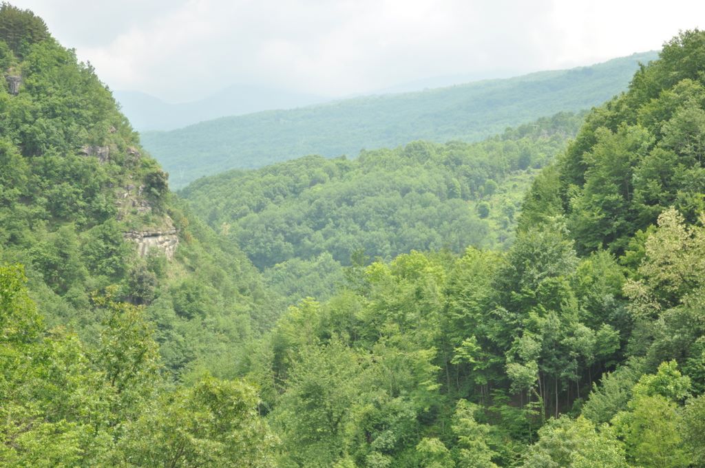
The Valle delle Cento Cascate, also known as Cento Fonti, in the Monti della Laga, is one of the most spectacular itineraries in the Apennines. Its name comes from the countless small waterfalls fed by the Fosso dell’Acero, which flows through ancient beech forests and wide rock slabs, creating a fresh, wild, and water‑rich environment.
Starting location: Cesacastina (hamlet of Crognaleto, TE)
Access: from the village square, follow Via Trieste northwards,
following signs for “Cento Fonti” or “Cento Cascate”. You cross clearings and
meadows in the area known as Le Piane before entering the valley of the Fosso dell’Acero.
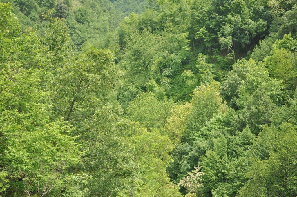
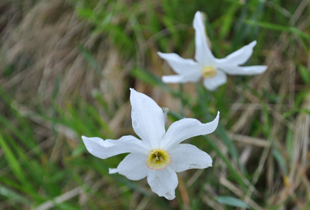
The trail begins with a gentle progression through wide clearings and beech woods, in a cool and shaded environment. In spring, the area is particularly rich in blooms, with many species of flowers and wild orchids typical of the Monti della Laga.
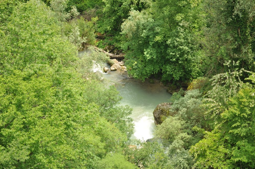
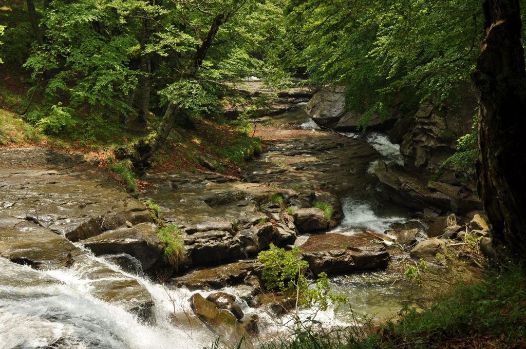
Gradually leaving the forest, you enter the heart of the Valle delle Cento Cascate. Here the Fosso dell’Acero flows over large sandstone slabs, forming an almost continuous sequence of drops, slides, and small waterfalls of various sizes, making the route extremely scenic and evocative.
The trail follows the stream, alternating between grassy sections, rocky stretches, and small fords. In several points the path gets very close to the water, allowing you to admire the waterfalls up close and stop in small basins and grassy terraces ideal for a break.
As you climb the valley, the environment becomes more open and wild: the waterfalls follow one another continuously, some small and intimate, others taller and more spectacular, creating a constant alternation of water sound, rock, and greenery.
In the upper part of the valley, the landscape opens toward the Cime della Laghetta and Monte Gorzano, the highest peak of the Monti della Laga. On clear days, the view extends toward the Gran Sasso massif and, on the horizon, all the way to the Adriatic Sea.
The route is generally classified as E, but can reach EE depending on water flow, mud, and slippery sections near the stream. A sure footing and some experience on mixed terrain (grass, rock, wet areas) are required.
Total length varies depending on where you choose to stop the ascent: on average 7–10 km round trip, with 700–900 m elevation gain and an indicative total time of 4–5 hours, including stops to admire the waterfalls.
The best period to fully enjoy the Valle delle Cento Cascate is roughly from May to July, when water flow is abundant and the environment is lush. In late summer the itinerary remains pleasant, but with reduced water volume.
| Technical Sheet – Valle delle Cento Cascate | |
|---|---|
| Starting point | Cesacastina (Crognaleto, TE) |
| Starting elevation | Approx. 1,150 m |
| Maximum elevation | 1,900–2,000 m (depending on destination) |
| Elevation gain | 700–900 m |
| Total length (round trip) | 7–10 km |
| Total time | 4–5 hours |
| Difficulty | E / EE (depending on water flow) |
| Terrain | Trail, grass, rock, slippery sections near water |
| Critical points | Fords, wet rocks, unclear trail sections |
| Recommended period | May – July (maximum waterfall flow) |
| Equipment | Boots, poles, waterproof jacket, GPS track |
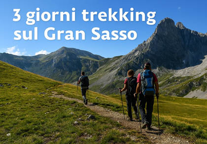
Route type: Trekking for hikers (Difficulty E – Medium)
Hiking time: to the summit 2:50 h
Starting point: near the power station.
A map is recommended
Pets allowed.


The most popular ski resorts, the updated snow report and useful information on how to find lifts or book accommodation for your winter holiday

View the webcams in Abruzzo and check real‑time weather conditions. Some webcams belong to www.abruzzoparchi.it, others are located throughout the region
Weather forecasts for the coming days in Abruzzo. Live weather via our webcams and temperatures recorded in several mountain areas
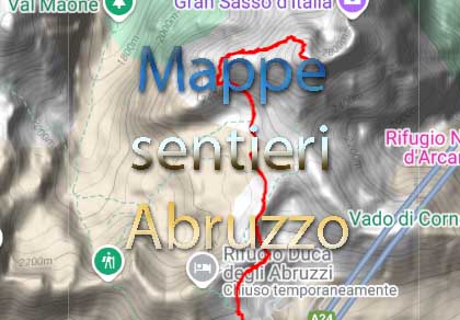
Maps for trekking, mountain biking, ski touring, running and horse riding. You can also download the GPX track of each route

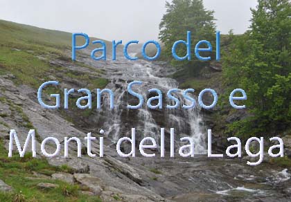
One of Italy’s most famous and oldest national parks
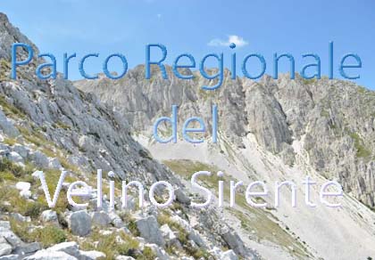
Located in the heart of the Apennines, home to the beautiful villages of the Rocche Plateau
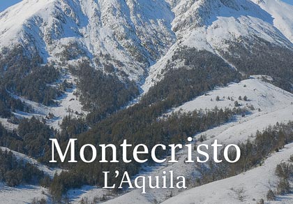
One of the snowiest places in Italy, a unique mountain massif rising close to the sea
Abruzzo’s villages are famous for their fortresses, mountains and the traditional trabocchi along the southern coast
Choose between sea or mountains, summer or winter, a sporty holiday or a relaxing one — Abruzzo has it all
Abruzzo is famous for its cuisine, both mountain and coastal, with traditions that vary from area to area
Walks, diving, climbing, mountain biking, horse riding — all outdoor activities available in Abruzzo
While travelling through Abruzzo, today we visited the 100 Waterfalls, also known as Cento Fonti (as written on the sign you will find in Cesacastina), or the Valley of Flowers, thanks to the beautiful blooms that can be seen in spring within the Gran Sasso and Monti della Laga National Park. For years I had heard about this so‑called earthly paradise, and finally I can see it with my own eyes! We leave very early in the morning and follow the road to the Valico delle Capannelle, which on its own is a succession of enchanting landscapes. We are in the Vomano river valley, and even from the road leading to the 100 waterfalls you can see it until it forms an artificial lake, Lake Provvidenza.


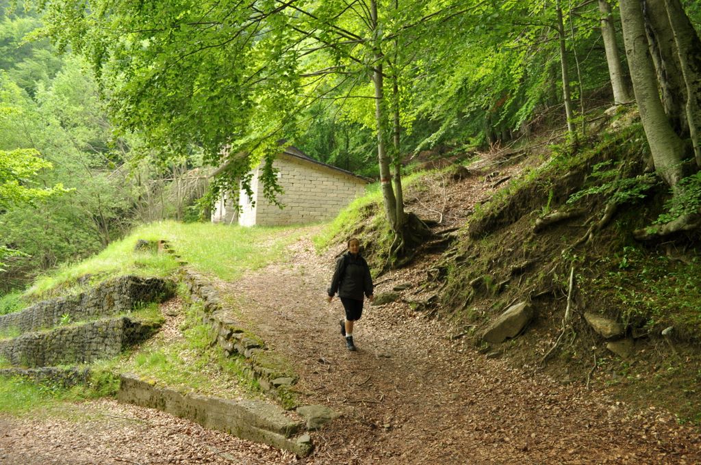
Following the directions of our trusted navigator, we climb the road leading to Cesacastina, a village in the municipality of Crognaleto, from where our adventure begins, after crossing a truly impressive bridge under which the Vomano river flows.


Once in the village, it takes us a while to find the starting point of the walk. There is a certain lack of signs around here, and it is necessary to ask the locals for directions.
After a long dirt road (luckily we have a 4x4), we leave the car at the beginning of our trail. Even here we still have doubts about the road we are following, although we are somewhat reassured by the sound of the water flowing nearby — abundant in spring, which is also the best season to visit this wonderful corner of Abruzzo.


The first part of our route is not very easy (later we discover that we took a shortcut that is not entirely “official”), especially because the ground is soaked from the recent rain, making it difficult to keep our balance. After about twenty minutes of walking, we are rewarded with the sight of the first of the promised 100 waterfalls. This is truly an enchanted place — the earthly paradise everyone talks about!

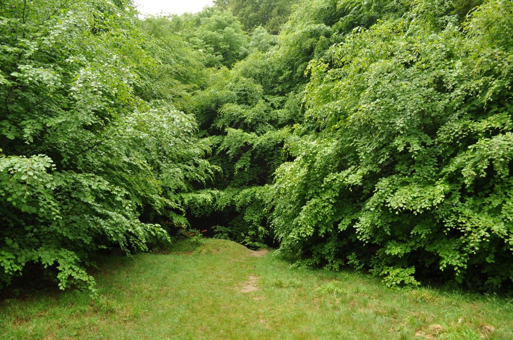

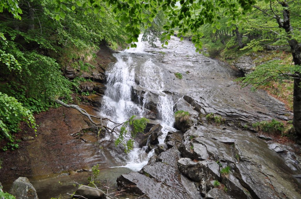
We find ourselves in a dense forest, climbing alongside a powerful stream that forms small and large waterfalls — a true delight for the eyes. One would almost want to step into the water, which must be freezing, but the sandstone terrain is extremely slippery, so it is better not to try. We continue climbing despite the heavy rain that has caught us. A few drops will not stop our exploration! After a while we leave the forest, but the scenery remains wonderful.
The waterfalls continue one after another, and right here, outside the forest, we reach what I believe is the most beautiful one.

And then, in the meadows, an explosion of colours! We are surrounded by flowers of every kind, large and small, in every colour... so many that we cannot even photograph them all as we would like!


Unfortunately, the day we chose is not the best... the rain has stopped, but a thick fog is rising which, although it does not prevent us from continuing, makes it pointless to try to reach the upper pastures.
From up there you can see the entire valley of Lake Campotosto... and Monte Gorzano, the highest peak of the Monti della Laga, which at 2458 metres is also one of the highest peaks in the entire Apennines. Today, however, we decide to turn back, continuing to follow the stream and enjoying the nature around us. Once back at the car, we head home with the promise to return soon to savour a little more of this paradise.


The most popular ski resorts, the updated snow report and useful information on how to find lifts or book accommodation for your winter holiday
Vai
View the webcams in Abruzzo and check real‑time weather conditions. Some webcams belong to www.abruzzoparchi.it, others are located throughout the region
Vai
Weather forecasts for the coming days in Abruzzo. Live weather via our webcams and temperatures recorded in several mountain areas
Vai
Maps for trekking, mountain biking, ski touring, running and horse riding. You can also download the GPX track of each route
Vai
Walks, diving, climbing, mountain biking, horse riding — all outdoor activities available in Abruzzo
Vai
Choose between sea or mountains, summer or winter, a sporty holiday or a relaxing one — Abruzzo has it all
Vai
Abruzzo is famous for its cuisine, both mountain and coastal, with traditions that vary from area to area
Vai
Abruzzo’s villages are famous for their fortresses, mountains and the traditional trabocchi along the southern coast
Vai
One of Italy’s most famous and oldest national parks
Vai
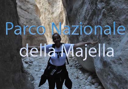
One of Italy’s wildest parks, with typical Apennine landscapes and Dolomite‑like peaks
Vai
Located in the heart of the Apennines, home to the beautiful villages of the Rocche Plateau
Vai
One of the snowiest places in Italy, a unique mountain massif rising close to the sea
Vai